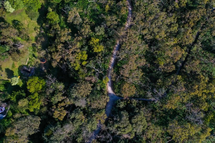
Council is undertaking a review of native vegetation and areas of environmental significance across the city.
The current mapping of native vegetation is based on surveys undertaken in 1997 and 2006, and reflected in the Environmental Significance Overlay (ESO 1) and the Significant Landscape Overly (SLO 1) of the Frankston Planning Scheme. Since the surveys were conducted, there have been significant changes to vegetation that require a review of these areas.
In order to plan well for the future, we need to ensure information related to the extent and quality of native vegetation across the municipality is up to date. It is important that this is reflected in the relevant overlays and within the Frankston Planning Scheme.
Council has been undertaking a review of its vegetation mapping since 2018 and is now in the final stages of this project. Consultant Vegetation specialists are reviewing the information and completing surveys of a number of sites throughout Frankston City. Site assessments will be completed during June and July 2022.
Site assessments are carried out at locations across Frankston City including:
- public land such as Council reserves
- selected private properties (where access is granted).
For properties where access has not been granted, assessments may be conducted using Council’s aerial imagery and from observations outside property boundaries. All property owners will be informed of the outcome of the assessment.
The site assessments include detailed quality assessments of patches of vegetation, undertaken using the ‘habitat hectare’ methodology, by an accredited botanist. The Department of Environment, Land Water and Planning (DELWP) administers the accreditation of vegetation assessors.
The following components of a patch of native vegetation are assessed against benchmarks to determine its quality:
- number of large old trees
- percentage canopy cover
- understorey complexity
- lack of weeds
- evidence of recruitment
- quantity of organic litter
- number and extent of logs.

Additional data relating to the context of the patch of vegetation within the landscape are also calculated, including:
- patch size
- quality of habitat in the neighbourhood of the patch
- distance to a large area of ‘core’ vegetation.
Each site is assigned a score (out of 100) that describes the quality of the vegetation and its value as wildlife habitat.
This process will identify both areas that may have previously been overlooked for their ecological value and areas that have been degraded and may no longer support significant ecological values.
These detailed surveys will form the basis of recommendations to Council about how to best manage the ecological values through the Planning Overlay provisions. They may result in recommendations to include a site within the coverage of ESO’s and SLO’s.
They may also include recommendations to remove or reduce the coverage of these overlays from a site or area due to changes in the coverage or quality of vegetation. For example, where a development has occurred and vegetation has been permitted to be cleared by Council under a statutory planning permit.
Environmental Significance Overlay, Schedule 1 (ESO1)
Frankston City Council’s Environmental Significance Overlay, Schedule 1 (ESO1) covers areas of ‘Native Vegetation and Fauna Habitat.’
The objective of the ESO is to ‘protect national, state, regional and locally significant vegetation and biodiversity within Frankston City Council’. For example, the internally significant, Seaford Wetlands, and regionally significant, Langwarrin Flora and Fauna Reserve, are covered by ESO1.
Significant Landscape Overlay (SLO)
The Significant Landscape Overlay (SLO) identifies significant landscapes and seeks to conserve and enhance the character of significant landscapes. Significant landscapes may include semi-rural areas that provide extensive vistas and are typically characterised by a landscape with undulating topography and a mosaic of pasture, remnant bushland and planted vegetation.
The objectives of the SLO is to ‘to conserve and enhance the area’s trees and native vegetation for its intrinsic, habitat and landscape values and to protect and enhance bio links across the landscape and ensure that vegetation is suitable for maintaining the health of species, communities and ecological processes, including the prevention of the incremental loss of vegetation’.
The intent of these overlays is to ensure any development occurs in an appropriate manner consistent with the values of the site. They do not prevent development. Dwellings, sheds, road upgrades and subdivisions can all occur in areas covered by the ESO and SLO’s.
However, the purpose of both the overlays is to ensure that the development and management of land avoids adverse impacts (particularly through vegetation clearance) and if impacts cannot be avoided, to minimise and mitigate against impacts through appropriate consideration and expert input to project design or management.
You can find out if your property is located within an ESO, SLO or other planning overly by contacting us or viewing the Frankston City Planning Scheme.
Most of the survey has been completed and there are only a small number of public land areas and private properties that require survey. For private landholders, participation is entirely voluntary and Council will contact those owners whose properties may need to be surveyed directly to discuss consent to access the area.
If you have been contacted by Council seeking permission to access your property for the survey, please fill out the Frankston City Council Native Vegetation Survey form.
Complete the survey form
A report recommending changes to the coverage of the ESO and SLO will be prepared and form the basis of a future Planning Scheme Amendment which will revise the coverage of these overlays, by including properties within the ESO or SLO, reducing the extent of the ESO or SLO or deleting either of these overlays entirely from a property.
The Planning Scheme Amendment process is likely to take place over an extended period during 2023.
The Frankston community and residents potentially affected by any proposed changes will be formally notified and have the opportunity to make a formal submission on the proposed Amendment. If objecting submissions are received, these will be heard in front of an independent Planning Panel appointed by the Minister for Planning.
More information can be found on the Planning Scheme Amendments page.
Amending a planning scheme is a legislated process that requires the approval of DELWP (Minister for Planning).
There a number of reasons why updating the Environmental Protection Overlay is important.
Frankston supports significant areas of native vegetation and biodiversity
Frankston City Council residents live in an area that is celebrated for its natural bushland and diversity of wildlife. It is these natural elements that support the health, wellbeing and quality of life for our community and visitors.
Remnant indigenous vegetation still covers about 15% of the municipality, making an important contribution to regional biological diversity and includes all 17 vegetation types that were here before European settlement.
The diversity of native habitats in Frankston is supported by its extensive network of Council bushland reserves and the conservation reserves managed by Parks Victoria. But while public land protects much of our biodiversity, some of the rarest habitats are almost exclusively found on private land.
Conventional wisdom in past decades has been that large national parks and conservation reserves would provide secure long term protection for biodiversity but the impacts of climate change are resulting in a new understanding and appreciation of the critical role of fragmented bushlands in urban and semi-urban areas.

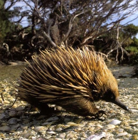
Echidnas are often seen in public and private bushland in Frankston
Overlays are key tools for Council to protect and manage natural assets
Managing threats to local biodiversity and improving the quality of the remaining habitat for plants and animals in our local area as well as balancing competing needs such as fire prevention and development are significant challenges for Council and the community and Council has adopted a range of policies and plans to help the community achieve this balance including local planning policies such as the Environmental Significance and Significant Landscape Overlays. Statewide Planning Policies and Provisions are also in place to protect and manage native vegetation and habitat.
It is critical that these key planning tools are based on accurate up to date information and mapping.

Privately owned bushland in Frankston provides important hunting grounds for the Endangered Powerful Owl
A large proportion of the remnant vegetation occurring in the municipality is located on private land. Remnant vegetation also exists in conservation parks and reserves (including coastal), recreation reserves, roadsides, waterway reserves, rail reserves and other public land throughout the City. Conservation and protection of the remaining native vegetation is a key element of Frankston Local Planning Policy Framework (Clause 12: Environment and Landscape Values of the Frankston Planning Scheme) where the objectives and strategies recognise the importance of protecting sites of significance for flora and fauna and ensuring that new development anywhere in the City does not diminish the integrity of Frankston City’s biodiversity (natural resources and the maintenance of ecological processes and genetic diversity).
Council policies and plans supporting sound management biodiversity assets and trees are:
- Urban Forest Policy (May 2017)
- Urban Forest Action Plan (June 2020)
- Biodiversity Policy (February 2018)
- Biodiversity Action Plan (November 2021)
For more information on the above plans and policies, visit our environment strategies and guidelines page.